
1.2 Natural Features
A. Geographical Location
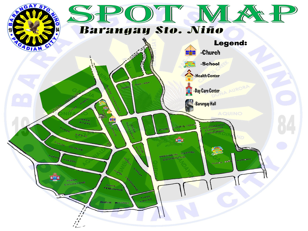
The Barangay is located at the Northwestern part of the City. It is categorized as one of the twenty two (22) urban barangays in the city. It has a density of 252.62 density per hectare. It is 1.2 Kilometer away from the city proper.
B. Land Use and AreaThe total Land area of the barangay is 30.2625 hectares which are categorized into residential and partly commercial.
Land Category Area (Hectares) Percent
Residential 20.0125 66.13%
Commercial 5 16.52%
Provincial Government-owned 5.25 17.35%
TOTAL 30.2625 100.00%
C. Elevation, Topography and Slope Characteristics
The Barangay has mixed topographic relief. The southwestern portion with level or nearly level sloping areas cover an estimated area of 20.82% of the total area of the Barangay. The middle portion has gently sloping landscapes that is covering an estimated area of 18.55% of the total area of the Barangay. Lastly, the western and central portions of this Barangay cover a largest portion of total area with an estimated area of 60.64% of its total land area.
Slope Category/ Characteristics Land Area (Hec) Percent
Level of nearly level 6.3 20.82%
Gently Sloping 5.613 18.55%
Moderately Sloping 18.35 60.64%
TOTAL 30.2625 100.00%
D. Climate and Rainfall Barangay Sto. Niño is located within the tropics of the northern Hemisphere which is characterized by pronounced dry season from January to March and rainy season from April to December.
Rainfall distribution is moderate from 2,500 mm to 3,000 mm annually. The prevailing winds are the southeast wind that blow shot gust wind from over the sea during dry season going northeast, and the trade winds brought about by the mountain range. The area does not experience typhoons due to its geographic location being situated away from the typhoon belt.
E. Surface Drainage
Water Bodies
Names of Major Water Bodies Physical Condition
within the Barangay
1. Balangasan River Filled with Wastes
2. Capitol Creek Dry during sunny season
3. Sandayong Spring (PCWD) Excellent Condition
